

This is our daily post that is shared across Twitter & Telegram and published first on here with Kindness & Love ❤️❤️ on My.Daz.blog
#AceNewsRoom With ‘Kindness & Wisdom’ Mar.17, 2022 @acenewsservices

Follow Our Breaking & Daily News Here As It Happens:
#AceWeatherDesk The La Nina climate driver, that has delivered Australia’s deadly floods, should right now be on the way out. But new data has revealed it has no plan to retreat any time soon according to News Media AU By Benedict Brook
Meteorologists have warned that far from La Nina petering out, the weather event has “stalled” and conditions for it are likely to “persist” for many more weeks.
That could mean more rain, cyclones and dangerous flooding as moisture is pushed towards Australia’s east and north coasts.
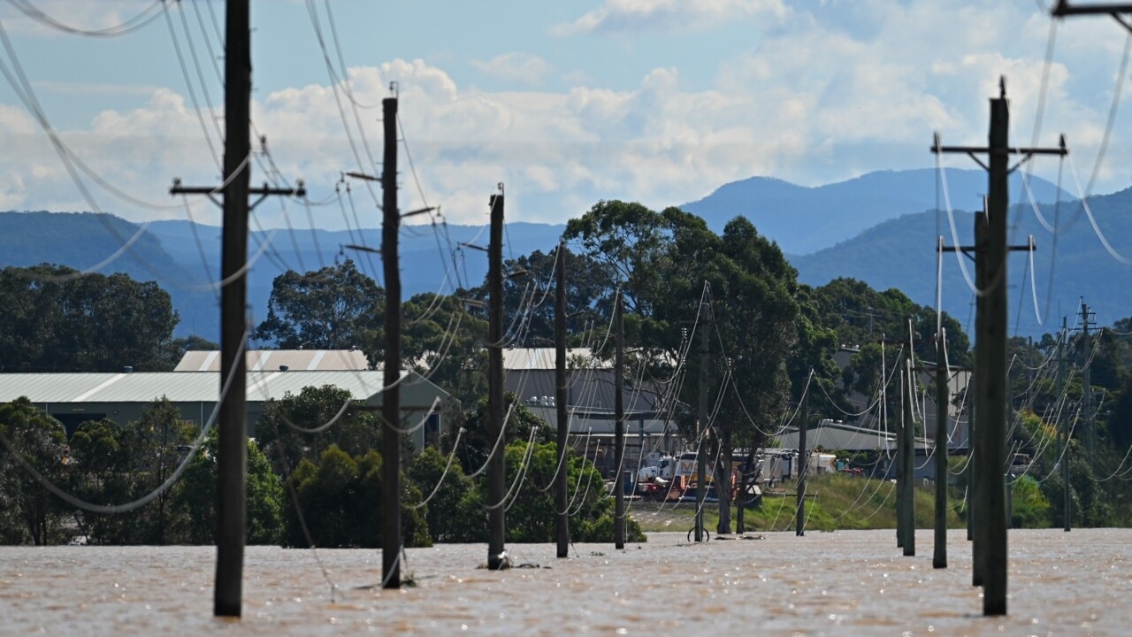
At least 23 people have died in Australia due to the recent flooding brought about by the extraordinary weather conditions.
A man perished in flood water in Broken Hill this week as the NSW outback town recorded its highest rainfall since records began in 1884 with 129mm coming down in 24 hours on Tuesday.
Sydney has sweated through its most humid summer for a decade and wettest such season in 30 years. In late February, Brisbane set a new three day record for rainfall levels.
Five people have died in and around northern NSW following floods centred on Lismore.
Much of the misery is down to La Nina.
Both it and its counterpart El Nino are two extremes of a major climate driver known by its full name of the El Nino-Southern Oscillation.
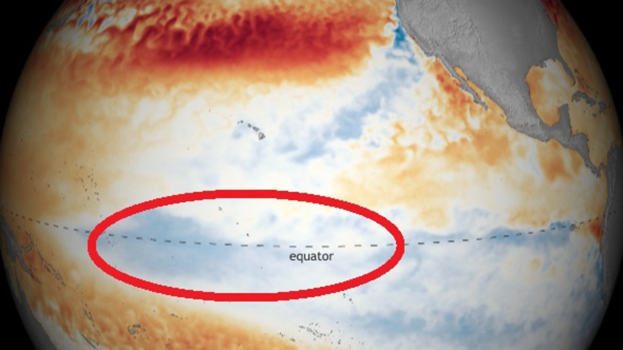
During a La Nina event trade winds ramp up dragging cooler waters from the depths of the ocean to the surface in the central and eastern equatorial Pacific.
These winds, travelling from east to west, in turn push warmer seas closer to Australia. That helps in cloud formation which brings more rainfall. La Ninas often coincide with more tropical cyclones.
Water temperature graphs from the Pacific Ocean show La Nina has stopped weakening
During La Nina years, the climate driver typically forms in late spring or early summer and subsides during autumn.
However, the current La Nina seems unwilling to do the decent thing and move on.
In a climate update released this week the Bureau of Meteorology (BOM) said the while the current La Nina would eventually weaken and dissipate, it’s “retreat had stalled”.
“The 2021–22 La Niña event continues but is past its peak,” the Bureau stated.
“However, trade winds remain stronger than average in the western Pacific, which has delayed further weakening of the La Niña over the past fortnight.
“Persistently strong trade winds over the past fortnight have driven a cooling to La Niña levels of the central tropical Pacific,” said the BOM.
“This has also cooled water beneath the surface, pausing the warming trend seen during January and February.
“Warming below the surface of the Pacific Ocean typically foreshadows a breakdown in La Niña, and usually occurs in the southern hemisphere autumn.”
La Nina’s stubbornness doesn’t just mean the moisture it brings could linger for longer. It could also mean the effects of another climate driver will be exacerbated.
The Madden-Julien Oscillation (MJO) is strengthening over the Indian Ocean and heading into waters north of Australia.
The MJO is a continuously circulating pulse of wind and cloud that moves through tropical areas of the globe. With the wet season in full swing and La Nina continuing, the MJO can add even more rain into the mix – particularly for northern Australia.
“Most climate models suggest the MJO is likely to move to Australia’s north, in the coming week,” said the BOM.
“The risk of tropical cyclone development is also expected to be elevated across parts of northern Australia and the tropical south Indian Ocean in the coming fortnight.”
In its April to June climate outlook, released earlier this month, the BOM forecast above average rainfall for most of northern and eastern Australia.
It said there was “an increased chance of unusually high rainfall (in the top 20 per cent of historical records) for April to June across the northern half of the NT, northern and western Queensland and small areas of western and coastal NSW”.
Other areas should have average rainfall aside from parts of Tasmania and south west Western Australia which could below average precipitation.

Editor says …Sterling Publishing & Media Service Agency is not responsible for the content of external site or from any reports, posts or links, and can also be found here on Telegram: https://t.me/acenewsdaily all of our posts from Twitter can be found here: https://acetwitternews.wordpress.com/ and all wordpress and live posts and links here: https://acenewsroom.wordpress.com/ and thanks for following as always appreciate every like, reblog or retweet and free help and guidance tips on your PC software or need help & guidance from our experts AcePCHelp.WordPress.Com

You must be logged in to post a comment.